

Skeleton Coast
Five hundred kilometres of coast where the desert enters the ocean, with shipwrecks in the sand, a seal colony and a salt road driven through fog — and a gate decorated with skulls
- When to go
- October 15° · 0 rainy days
- Per day
- €€€€price 4 of 5
- How many days
- 1days
- For you
- 6 questions →
- Right now

The Skeleton Coast is a drive, not a destination: the salt road up the Atlantic from Swakopmund north, through Cape Cross with its seals, past the wreck of the Zeila and through the skull gate into the national park, then east into Damaraland. A whole day, two hundred and fifty kilometres of fog and sand, and the one day on the loop when it seems nobody else is on the planet.
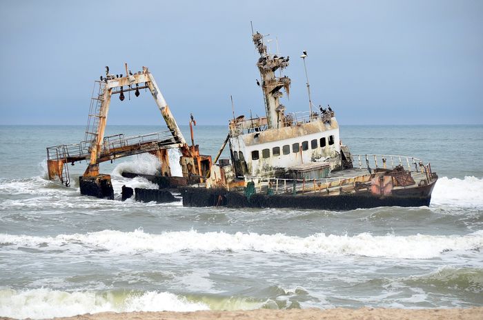
The name Skeleton Coast is twentieth-century, from a news report and a book about the wrecks; the older nickname is Portuguese — sailors called this coast the gates of hell. The reason is the same for both names: the cold Benguela current, fog and currents threw ships onto the sand for centuries, and the survivors found themselves between the ocean and a desert without water. Today the wrecks are seen from the road — the Zeila, a fishing boat stranded in 2008 south of Henties, stands in the waves a hundred metres offshore and is the easiest to photograph; the older ones are buried in sand or deep in the park, where you cannot go without a permit and a guide. The road is salt and gravel, flat and empty, with one fuel station at Henties in a hundred and fifty kilometres.

The first stop is Henties Bay, about an hour from Swakopmund: a salt lake by the road with flamingos, a fishing settlement with huts that stand empty half the year, and the only fuel station in a hundred and fifty kilometres. Cape Cross is half an hour further north — a seal colony of a hundred thousand and more, with a boardwalk through it, jackals waiting and a smell that does not go away; entry is paid at the gate, check the amount. From there it is another hour to the Ugabmund gate with its skulls, where the national park begins and a transit permit is paid — about eighty Namibian dollars per person plus the vehicle, and required even to pass through.
The southern part of the park may be driven without a guide only in transit, from Ugabmund to the Springbokwasser gate in the east, with a ban on leaving the road and a deadline to be out by the afternoon; the northern part above Terrace Bay is closed to all but guests of one lodge reached by air. The transit is a hundred kilometres of desert with one gravel road to Torra and the wreck of the Montrose, then the road east through hills into Damaraland — Twyfelfontein with its engravings and the Brandberg — where you sleep. Anyone who does not reach Springbokwasser before closing time is stuck at the gate overnight — camping in the park's transit zone is not permitted, so build in a safety margin.
What to see in Skeleton Coast
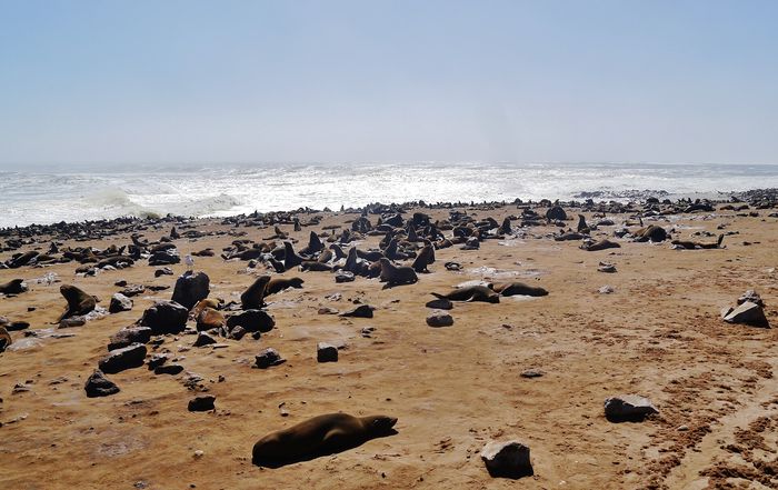
Cape Cross
The seal colony on the cape with the Portuguese cross, an hour and a half from Swakopmund, with a boardwalk through it. In the morning, when they are ashore; by noon they are in the water. Entry at the gate — check the amount; half an hour is enough, the smell decides.
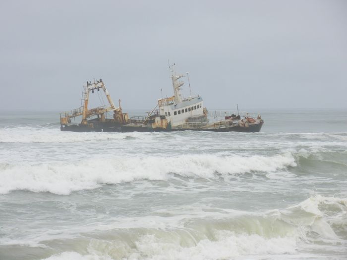
The wreck of the Zeila
A fishing boat stranded in 2008 south of Henties Bay, in the waves a hundred metres from the road, with cormorants on the mast. The most accessible wreck on the coast; you park by the road and photograph it in fog, which here is the rule.
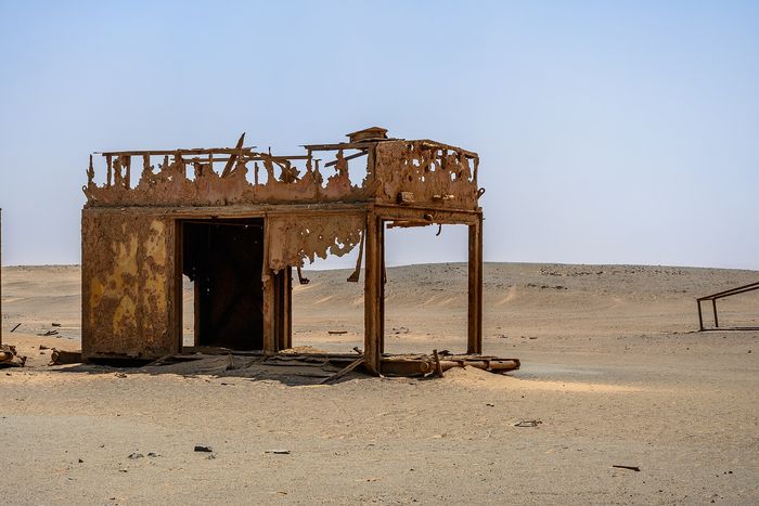
The Ugabmund gate
The national park gate with skulls and crossbones on the sign, where the transit permit is paid and the entry time recorded. The photograph everyone takes; after it, a hundred kilometres of nothing.
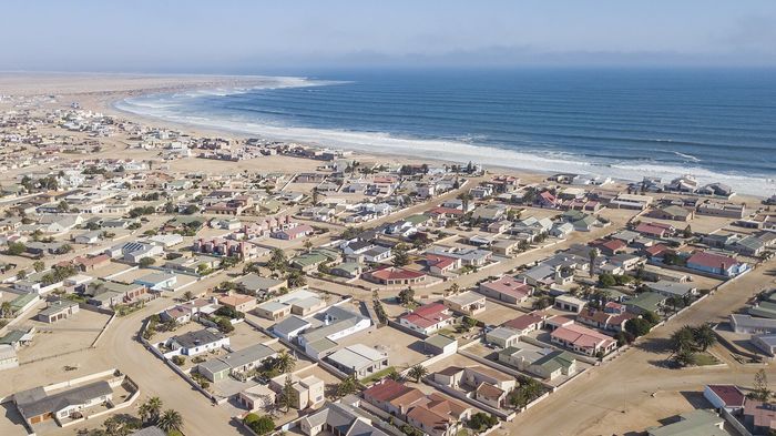
The salt lake at Henties
A shallow lake by the road at Henties Bay, with flamingos and salt works, on the way to Cape Cross. A ten-minute stop; pink on grey is the only colour on the whole coast.
The Ugab canyon and Damaraland
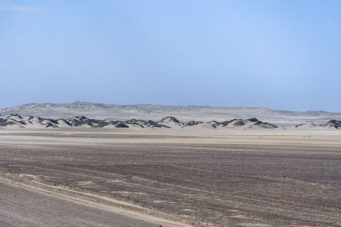
The road east from Springbokwasser through the dry Ugab river and the hills of Damaraland, with desert elephants sometimes seen in the riverbed. This is the exit from the coast and the finest part of the day, in the afternoon, with low light.
Henties Bay
A fishing settlement with one fuel station, a shop and a restaurant, where you fill the tank and buy water. The only stop in a hundred and fifty kilometres; not skipped, however full the tank.


Two things you probably did not know
The Skeleton Coast takes its name from the shipwrecks and whale bones along the sand. Fog and currents ran ships aground for centuries, and survivors who reached the shore found a waterless desert.
A seal colony of tens of thousands lives on this coast, feeding in the cold Benguela current. That current brings food up from the ocean floor and is why the sea here teems with life while the land is empty.
Ready for Skeleton Coast?
Within reach from here
Places sorted by straight-line distance from Skeleton Coast — day trips or weekends.

Namibia
→A country you drive rather than visit: about four people per square kilometre, gravel roads without end, and a safari done in your own car as in Kruger — only without the fence

South Africa
→A country of long distances and reversed seasons, driven on the left throughout

Kenya
→A safari charged by the day, not by the trip — a reserve whose gate fee doubles in July, while a whole trip costs only half as much more

Chile
→A country 4,300 kilometres long and 180 wide — driest desert on earth to glacier, without a single turn
All 277 places we write about sit on one page — narrow them down by continent, country, price or what you are travelling for.
Within reach from here: Swakopmund, Windhoek and Sossusvlei
See how much of that actually suits you — or pin Skeleton Coast if you have been.
Front row for the next trip
Leave your email and we'll let you know when a new destination or story goes up.